Next-Generation
Urban Tree Mapping
An open-source geospatial platform designed for community initiatives, researchers, and municipalities to inventory, monitor, and protect urban ecosystems. Combining high-precision field data collection, automated background processing, and street-level verification tools, this application transforms community action into actionable ecological data for resilient urban planning.
Data Collection
The platform provides a streamlined workflow for gathering accurate data on urban vegetation directly from the field. These tools focus on precision mapping, visual documentation, and efficient data handling to ensure high-quality data collection in any urban environment.
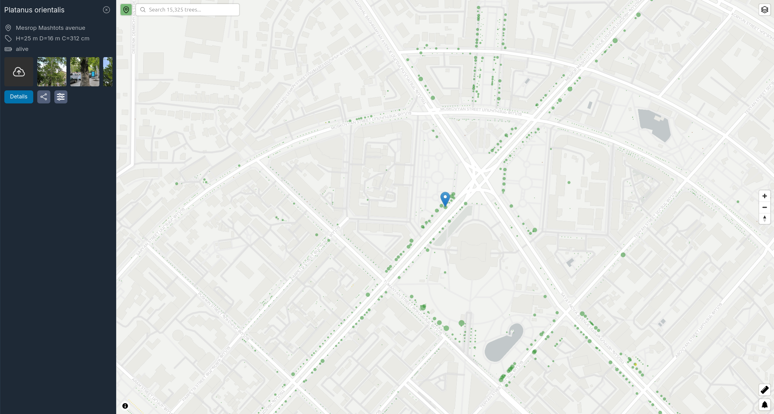
Interactive Mapping
Tools for precise geolocation and visualization, including features to quickly add rows of trees and manage draft entries.
Visual Documentation
Support for photo updates to track health and growth over time.
Optimized Data Usage
Support for background photo uploads when on Wi-Fi, preserving battery and mobile data while working in the field.
Tree Bookmarks
Ability to track specific trees of interest for easier follow-up and monitoring.
Custom Imagery
Support for custom map tiles, enabling the use of high-resolution internal aerial imagery for precise local mapping.
Street View Integration
Support for 360° street-level imagery via Mapillary, including specialized tools to triangulate and verify tree positions directly from the imagery.
Accessible Technology
Create accurate maps using standard consumer-grade devices. The platform is designed to produce professional results without requiring expensive surveying equipment.
Efficient Survey Modes
Choose from various survey modes tailored to your available tools. The platform offers optimized workflows that adapt to your equipment and team size to maximize productivity in the field.
Mobile-First Collection
Use your existing smartphone to collect all data in the field through a specialized mobile interface, then switch to a laptop for in-depth data analysis and management.
Management and Analysis
Beyond data entry, the platform offers robust tools for organizing and analyzing your urban forest database. From AI-assisted insights to global data exchange, these features support long-term environmental planning.
Powerful Search
Built-in search functionality to quickly find trees based on species, address, or any other collected attribute.
AI & Agent Integration
Native support for the Model Context Protocol (MCP), enabling AI agents to perform complex queries, generate reports, and provide deep insights into your urban forest data.
Comprehensive Analytics
Detailed reporting including biodiversity indexing, species leaderboards, and street-level coverage statistics to help prioritize greening efforts and track environmental goals.
OpenStreetMap Integration
Bidirectional data exchange with OSM, allowing for pulling existing tree data and pushing local updates back to the global map.
Performance
A Rust-based backend capable of managing large datasets with minimal infrastructure requirements.
Data Portability
Export your data in standard GeoJSON format for use in QGIS, ArcGIS, or custom web APIs. Your data remains accessible and compatible with industry-standard GIS tools.
Community
Tree Maps is built to facilitate collaboration between volunteers, administrators, and the public. These tools help coordinate field work, manage contributions, and engage the wider community in urban forestry efforts.
Communication Tools
Integrated commenting system to facilitate discussion between team members and administrators about specific trees.
Incident Reporting
Integration with Telegram for real-time reporting of tree damage or maintenance needs by volunteers and the public.
Access Control
Granular permissions to manage contributions from volunteers and staff, ensuring data integrity while encouraging wide participation.
Public Engagement
A user-friendly public interface that allows citizens to explore their urban forest, learn about local species, and follow greening progress.